So much information, so many surprises, so many alignments which are almost unexplainable. Unlike Henry Lincoln who veered towards a belief in something magical or of great religious significance or both, I began to fear that someone somewhere was perpetrating the most complicated joke, possibly based around a knowledge of some ancient system of navigation, perhaps a different form of triangulation.
Triangulation
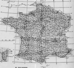 This diagram is an outline of the underlying triangulation which forms the basis of the IGN maps. I hope you will agree with me that there is a series of “paths” apparent on this diagram, forming a wiggly cross with a a couple of side branches. I looked at this diagram for a long time before realising the cross can be seen not because the line weight is heavier but because the outer edges of these paths are relatively smooth paths certainly not as random as the rest of the triangulation.
An Earlier System
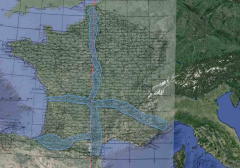 To emphasis the effect I have provided an outline and compared it with the Paris meridien. I have then shown the location of the alternative navigation system I was evaluating. It only shows as a small white blob in the bottom centre, but it can we seen that it lies on the wester wall of one of the pathways.
Here now is a closer view. What I am doing is testing it out the viability of an earlier a navigation system which might have used Pentacles and of which the Rennes pentacle is simply the bast known example. It seemed sensible to start with the middle route which could have been taken by the Visigoths on their travel south from Carcassonne. If there is any validity in my speculation, it would have been here that the navigation system would have been used.
Lacework of Pentacles
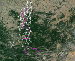 Each of the white pentacles is an exact copy of the Lincoln pentacle. Several different ways of arranging these additional pentacles was tried until this arrangement was decided upon. It is at this point that some interesting alignments emerge. We know of course that the Lincoln pentacle has one of its points sitting on Château Hautpol at Rennes Le Château. We have positioned the white pentacles so that they stretch back to Carcassonne. I half expected that the point of the most northerly pentacle would lie on Carcassone.
La Cité
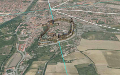 In fact it doesn’t! The point of the pentacle is just north of “La Cité” The blue line which is one of the alignments of the pattern of pentacles does pass through La Cité however and in fact it passes directly through the Château.
Comparisons with the Meridien
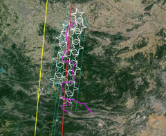 It is possible to draw N-S lines through key points of the pentacles. They are in fact a few degrees off n-s Here they are compared with the line which was identified previously between Barcelona and Dunkerque which also passes though both the Eiffel Tower and the Arc de Triomphe. (See Devil’s Line).
Montjuich
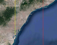 It can be seen that the blue lines are running at different angle to the Barcelona -Quillian-Eiffel-Triomphe-Dunkerque line. The are in fact converging and one of the lines passes directly through Montjuich. So that comparisons are easy to make this diagram also shows the Paris Meridien (red) and the Dunkerque-Barcelona line (yellow)
Sagrada Familia-Again
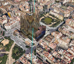 Another one of the alignment lines passes through, surprise, surprise, Sagrada Familia.
Lille
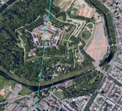 Moving to the north a third blue line passes directly through the Citadel of Lille. These multiple alignments probably mean that the network of Pentacles spread throughout Charlemagne’s Empire!
Long Distance Alighnments
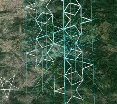 In fact the blue lines, representing pentacle alignments, run in every direection and along every line the path is defined by points of the pentacles.
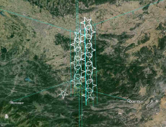 There are possibly dozens of alignments which can be obtained by extending these lines. I have selected a small number which I find intriguing. One extension leads to the Brenac pentacle which incidentally is smaller and may be part of a totally different system. The most southerly point of the pentacles shown is on the Pic de Thauze almost always known as the Pic de Bugarach, the mountain which dominates the whole area. Of the other two alignments shown in the lower part of the diagram one leads Monsegur the other to Queribus. They are both castles which were cathar strongholds at the end of the Albigensian Crusade
Monsegur
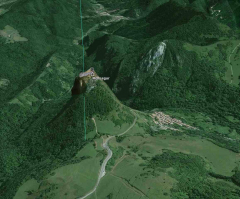 Once again the alignment is not just approximate. Monsegur is a “pog” of a relatively small diameter and yet the intersection is precise.
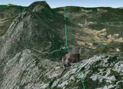 Similarly with Queribus. In this case it sits on top of a ridge but the intersection is just as precise. This is undoubtably a viable navigation system.
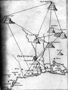 The Cassini family who for four generations gradually mapped France by triangulation are supposed to have possessed special skills. Is it possible that those skills were centred on knowledge of the earlier mapping systems? That the triangulation hid the fact that there already was a comprehensive system? Certainly, these early Cassini notes show that he quickly moved into now familiar territory. At the top of the diagram is Bugarach. In the middle of the diagram is Queribus.
Familiar Territory
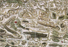 Cassini started with is base reference as Perpignan and initially worked north along the line of the various north -south “meridia”. Therefore very early in his work his mapping covered the areas of Rennes, Quillian and Brenac.
