Where is Occitan?
A quick answer is-
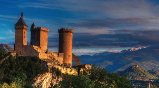
In the south of France, south of the Central Massif and bordering the Mediterranean, stretching from the Alpes in the East to the upper reaches of the Garonne River in the West.
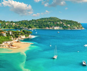 To those who holiday on the Cote d’Azur…
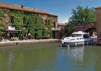
or while away time meandering on the Canal du Midi ….
this may be an adequate answer, but for others it may not.
Revolution
Finding a specific location, drawn from the history books, on a modern day map is problematical. In 1790 Following the French revolution the revolutionary council changed the map of France.
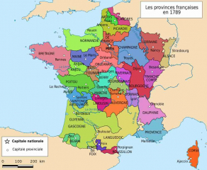 Up until that time the map showed provinces which were based around the holdings of the great landowners.
However one of the great anomolies in that “Ancien”system was that the southern provinces of Guienne and Languedoc were much greater than any of the other provinces, perhaps symbolising the fact that these areas had been taken by force by the French crown removing the rights of the previous landowners.
During the Revolution, 40,000 people were executed, most of them nobles.
The administrative system was changed to a three level structure af which the base was communes owned and managed by the people .
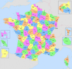 These communes were then grouped into departements, not provinces.
The departements were generally named afer geograhical features.
The objective of the revolutionary council was to totally erradicate the names of the landowners from memory.
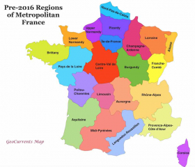
Finally, in the revolutionary system, the departments were grouped into regions. this final level of administration was purely administrative.
Armagnac
As an example: The area previously controlled by the comte of Armagnac became Gers . Gers is the name of a river which runs through the area.
Auch, Capital City ofArmagnac. became Auch, Gers, Midi-Pyreneees
 Despite their best efforts to eliminate any memory of the Comte d’Armagnac the earlier owner, they did not quite succeed. The brandy of the area is still called Armagnac.
Navarre and Bearn
Similarly Bearn and Navarre previously controlled by the Henry III king of Navarre.(and HenryIV of France) became Pyrenees Atlantique.
Pau, Capital city of Bearn , became Pau, Pyrenees Atlantique, Aquitaine

Nevertheless we still enjoy Bearnaise sauce.
Re-organisation
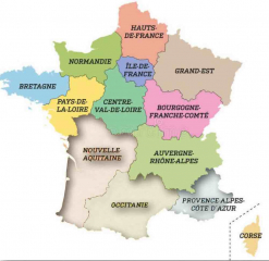
The French Goverment, In a five year exercise culminating In 2016, reorganised the structure of its administrative regions. The revolutionary departements have been unchanged but the way they have been grouped into regions has.
The changes have been introduced to make savings in administratice costs by reducing the number of regions, but it has created a very interesting result
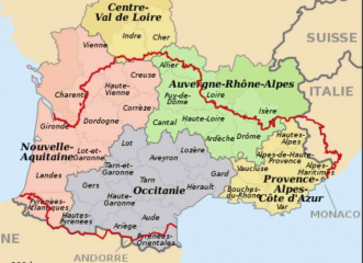 Twelve departements have been grouped together to form Nouvelle Aquitaine, in a recreation of the possessions of the English crown, as they were in 1360 .
Six different departements make up the rather clumsily named Provence-Alpes-Cote d’Az ur. which is a recreation of the Aragonese possessions of about the same time.
Another thirteen departements have been grouped together into a single administrative region of Occitaine., thus giving the people of this area what they wanted for a long time; a recognition their unique identity.
There is no historical precedent for the name Occitanie. Occitan is the name of a language, not of a sepecific geograpical area. However the people living in the area are both proud and vocal in support of their unique identity. The choice of the name was driven by the people who voted overwhelmingly in favour of its creation.
 Those who still have ambitions to create a separate state have however been quick to point out that places where the Language of Occitan was and to a certain extent still is spoken covers a much wider area, (shown as a red line on the map)
Aquitaine
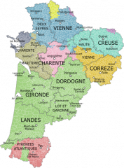
From the very beginning there were politics involved in the redefinition of regions. The people in the departements of Nouvelle Aquitaine really wanted and voted overwelmingly for simply Aquitaine but were blocked by polititians from Poitou and Limousan, now included in the new region.
Occitanie
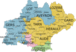
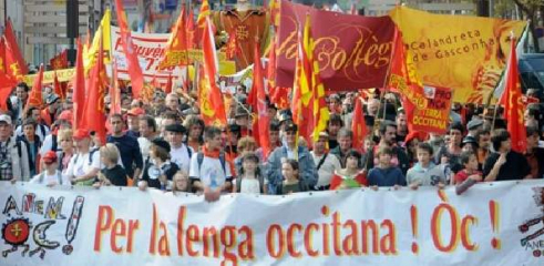
As the plans for the redefinition of regions was first discussed and then tabled in the various assemblies there was a vocal and highly visible campaign to use the name of the language and culture of Occitan for the region. Eventually the people and the politicians agreed. The decision was widely celebrated.
Provence
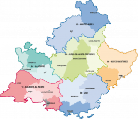 if the trend in the selection of Nouvelle Aquitane and Occitaine had been followed through it could have been expected that the name Provence would have been given to this Region. However the politicians were determined to retain the prestigeus Cote d’Azur in the name. Nor surprisingly this made the retention of the existing name Provence-Alpes-Cote d’Azur almost inevitable. Already it is being shortened to PACA. Not I think what anyone wanted!
The Big Picture
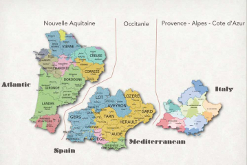 If the three southern regions are brought together, all of which have Occitan speakers. this gives a good impression of where greated occitan can be found.
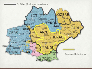 The only question is how does the modern region of Occitaine compare with the historical concept of where thecore occitan state might lie. It turns out there is a remarkable correlation!
 There remains an additional question; who were the peoples of occitan? Why to this day do they see themselves different from ‘Le Francais” who live north of the Centrale Massive.
